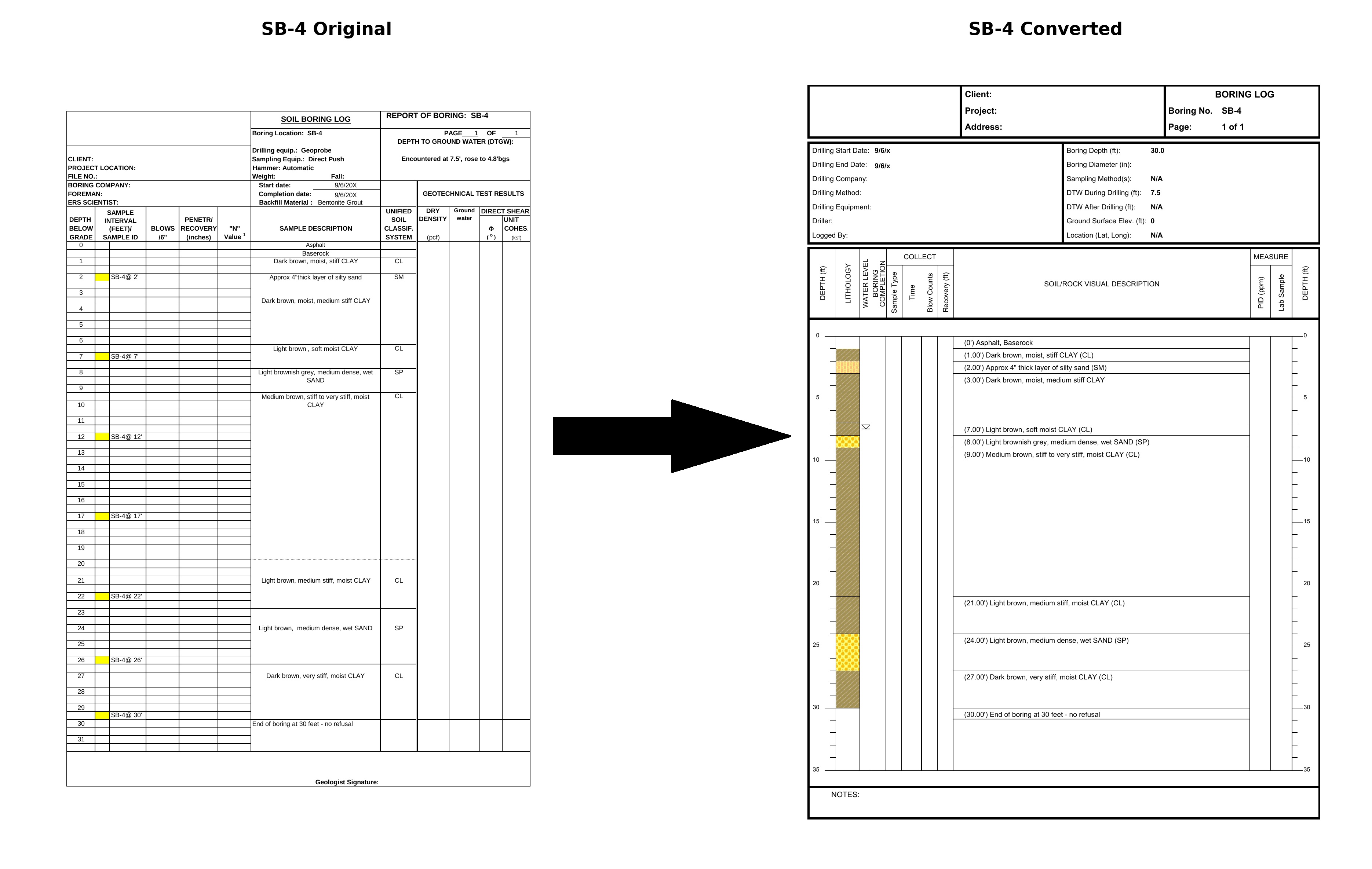
Upload legacy boring log PDFs and the platform automatically extracts structured data — lithology graphics, USCS codes, soil descriptions, SPT values, and groundwater elevations — ready to drive cross sections, 3D models, maps, and reports with no manual re-entry.
This is especially valuable on projects that mix boring logs from previous consultants with logs generated in LOGitEASY.