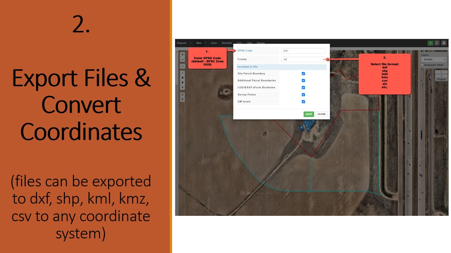
Export and Convert GIS Data and Coordinates Online
The default export file coordinate system is US State Plane (SPC) coordinate system in US feet (ftUS) – for projects in USA, or EPSG: 3857 (the projected coordinate system based on the WGS84 datum) – for projects in other countries ; however, you can transform your data to any other coordinate reference system if you know the EPSG code for that coordinate system. Our conversion service supports more that 3000 different coordinate systems, including WGS 84, WGS 84 / UTM zone, NAD27, NAD83, SPC (State Plane – ftUS, fti, m), and others.
Available export file formats : dxf, shp, kml, kmz, geojson, gml, gpx, mapinfo, dgn, gpkg, sqlite, csv, ods, xlsx.
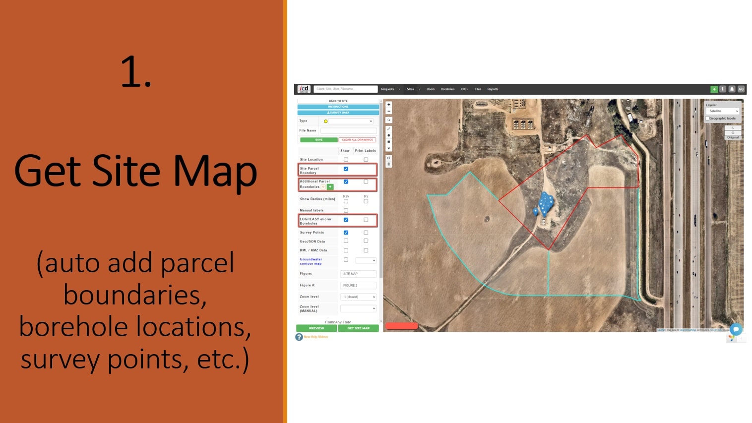
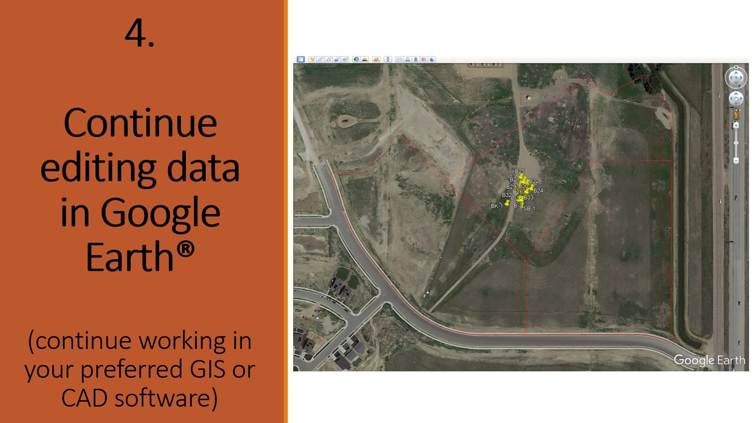
Survey information can be added by importing KML, CSV, GeoJSON files, adding points manually, or drawing features free hand. LOGitEASY eForm boring & well locations as well as project property and neighbor property parcel boundaries are added automatically (USA), provided borehole coordinates are entered/uploaded and/or correct site address added.