Faster, more powerful DIY Geologic Cross Sections
With the latest LOGitEASY software update, DIY geologic cross sections can now include Fill and Alluvium, as well as Possible Fill and Possible Alluvium, displayed side-by-side with detailed lithology descriptions.
Read more2026-01-16

Display Sample Results on Geologic Cross Sections
New Functionality - quickly upload and display sample results on a cross section — blow counts, recovery/RQD %, cave or refusal depth, water elevation, contamination data, etc. Reach out to learn more.
Read more2025-09-24
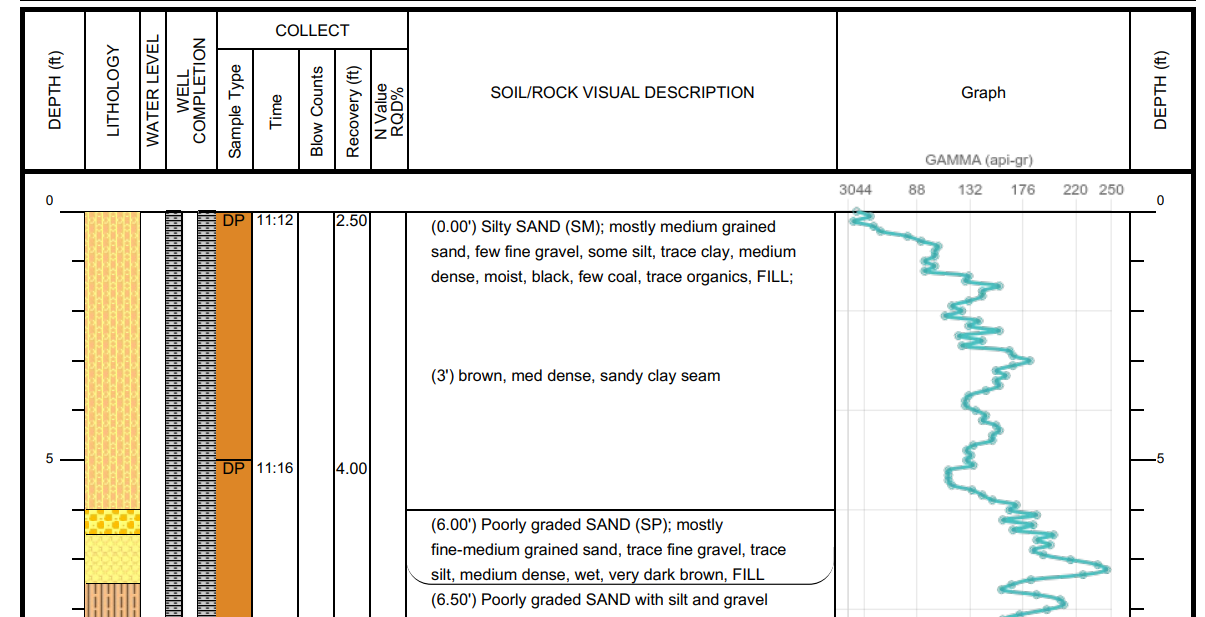
Wireline logs are now live!
Graph everything from resistivity, density, and hydrogen content to gamma rays, sound waves, and NMR — if it has depth and data measurement, you can chart it.
2025-09-15
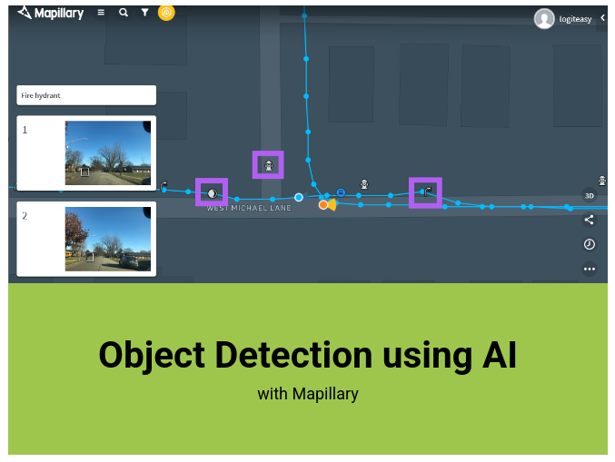
NEW - Surface Object Detection Using Computer Vision and Machine Learning
We’re integrating LOGitEASY’s mapping software with Mapillary’s object detection, powered by computer vision and machine learning. Starting with features like manholes, catch basins, fire hydrants, water valves, utility poles, and streetlights, software can automatically identify and map surface objects using global street-level imagery from the Mapillary community; or your own photos from field investigations.
Read more2025-04-16
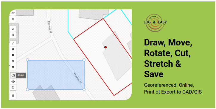
MOVE, ROTATE, STRETCH, CUT - NEW EDIT FUNCTIONALITY FOR DIY MAPS
We’ve added some new editing features to our DIY mapping tool. Now, users can easily move, rotate, stretch, and cut rectangles and polygons directly within the platform.
Read more2025-01-24
Limited-Time Black Friday/Cyber Monday Deal!
Elevate your team’s soil logging standards and streamline report figure generation with our Black Friday Sale - 35% off all annual LOGitEASY subscriptions! Black Friday DEAL
Read more
Image by Freepik2024-11-21

Add Image Overlays to Aerial or Street Map Backgrounds
We are excited to announce a major addition to our DIY mapping functionality, allowing users to import and overlay images such as engineering line drawings and field sketches onto aerial or street-view backgrounds with ease. Georeferenced. Online. Image Overlays
Read more2024-10-02
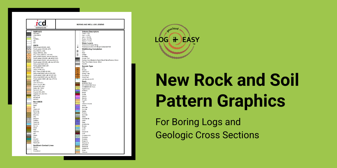
New Rock and Soil Graphic Patterns
Many of our clients have requested additional rock patterns for boring logs and cross sections. In response, we’ve recently updated LOGitEASY Rock Pro functionality to include new graphics for sedimentary, igneous, and metamorphic rocks, as well as for Alluvium, Colluvium, and Residuum. New Graphic Patterns
2024-08-28
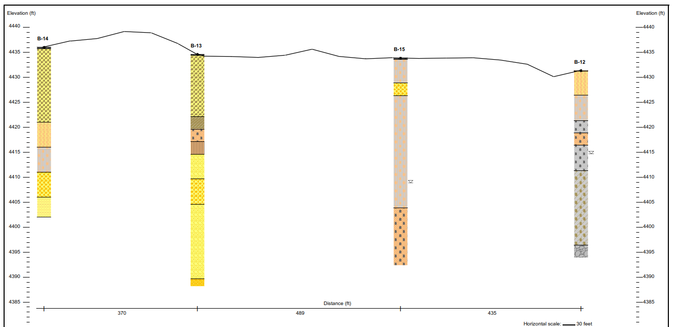
Use Google Ground Surface Elevation Profile in Cross Sections
Simply check 'Use Google Ground Surface Elevation Profile' check box and your cross section will be generated using Google elevation data for ground surface. DIY geologic cross sections can be generated online, free with finalized premium logs.
Read more2024-01-26

Create Isoconcentration Maps and Heat Maps within seconds!
Introducing new functionality to our do-it-yourself report figure software! With a few clicks you can now create isoconcentration and heat maps online using previously logged boreholes or newly added survey points. Data can be added manually or uploaded from a csv file. Online isoconcentration map functionality complements LOGitEASY’s other GIS mapping features: site topographic maps, site plans, groundwater contour maps, analytical box figures, boring logs, and geologic cross sections. No specific GIS or CAD skills required. See how it's done
Read more2023-07-31

Easily create and print Soil and Groundwater Analytical Data Maps online
Introducing new functionality to our do-it-yourself report figure software! You can now add soil or groundwater analytical data to previously logged boreholes or newly added survey points and print report-quality maps for environmental site assessment or monitoring reports. Analytical map functionality complements LOGitEASY’s other online features: site topographic maps, site plans, groundwater contour maps, boring logs, and geologic cross sections. Plus, it is very easy - no need for special GIS or graphic software knowledge. See how it's done
Read more2023-05-04
Introducing Dashboard
See out new Dashboard for easier navigation and latest notifications Dashboard includes three sections: INBOX - with latest work request delivery and clarification notifications, CREATE - for quick work request and figure creation, and LEARN - to access Start Guides, Video Playlist and FAQs. Please provide your feedback by sending us a message (lower right corner of the page).
Read more2022-10-31
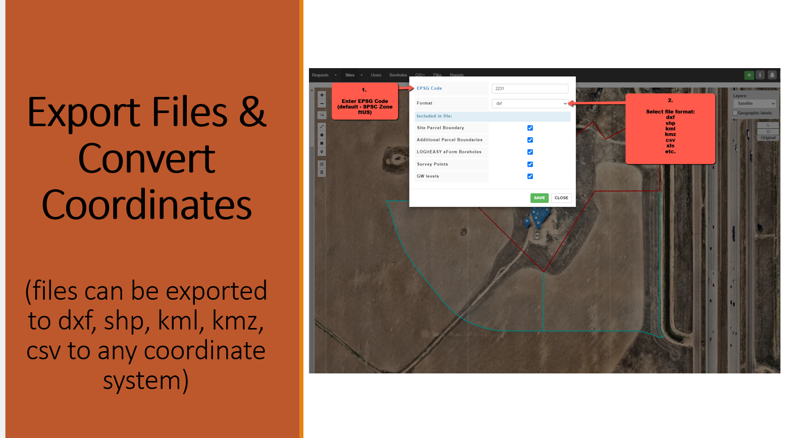
Export Parcel Boundaries & Borings to dxf, kml, shp, etc.
We now have a very easy way to add project property boundaries, boring locations, survey points, etc. AND to convert them into various data formats (dxf, shp, kml, etc.) as well as different coordinate systems. This allows quickly getting workable files with correct property geolocations in the desired coordinate systems, e.g. SPC (ftUS) or UTM (metric). Files can then be edited in your preferred software (AutoCAD, Google Earth, ESRI, etc.). Reach out if that is something you’d find useful for your projects.
2022-09-08

Online Groundwater Elevation Contour Maps Coming Soon...
In addition to online boring logs, geologic cross sections, site location maps, and site maps, we will be adding more DIY services, latest being Groundwater Elevation Contour Maps online! Simply add groundwater elevation data to your LOGitEASY well locations, or upload survey points with coordinates & add or import groundwater elevations, and generate contour maps online within seconds! Send us a message if you’d like to learn more!
Read more2022-04-01
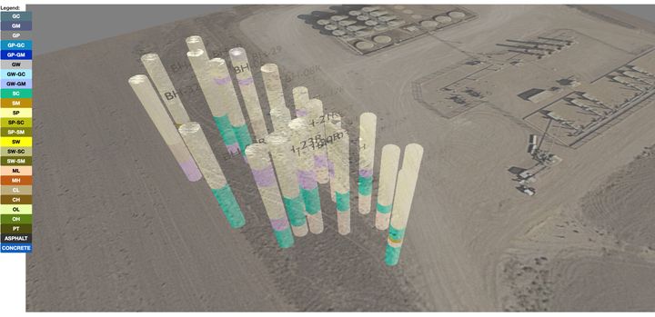
Impress your clients with 3D Geology Models of your project site!
In addition to soil logging, boring logs, 2D cross sections and DIY site maps you can now get 3D lithology models for your project sites. Then imbed the models in MS Word reports, edit in AutoCAD or other 3D modelling tools. As low as $50/model. Contact us to learn more!
Read more2021-10-15
 2021-09-27
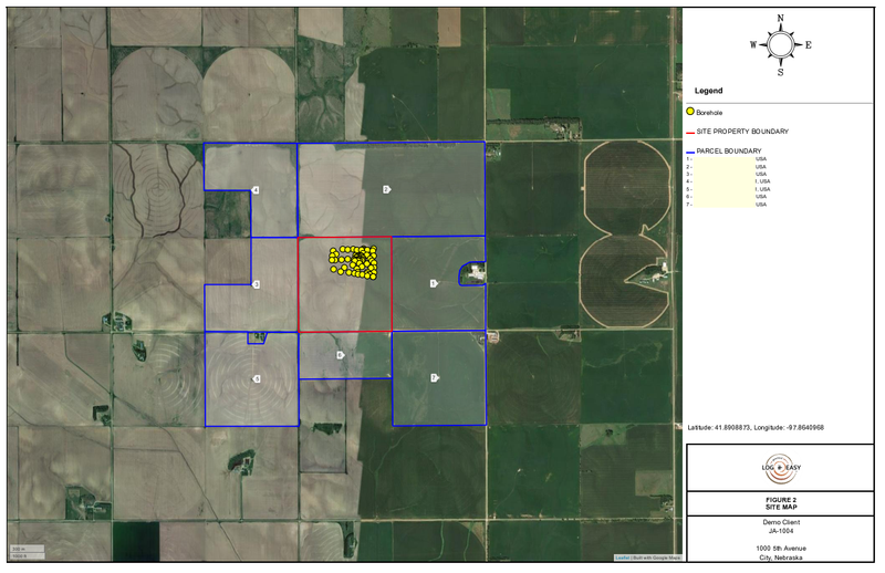
Simplified Menu and Point-to-Point Cross Sections
We’ve simplified the main menu by hiding ‘Clients’ and ‘Offices’ sections, and added a couple new software features.
Read more2021-09-13
 2021-04-23
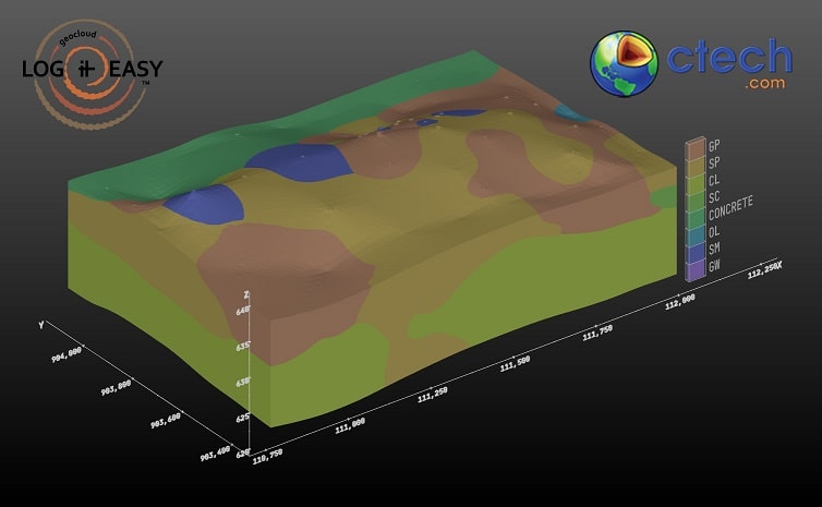
LOGitEASY announces integration with C Tech
We are very pleased to announce our integration with C Tech Development Corporation, the authors of Earth Volumetric Studio (EVS), the world’s leading three-dimensional volumetric Earth Science software system. LOGitEASY offers the only boring log software (and service) which supports C Tech’s newest file format for lithologic data. LOGitEASY clients are now able to export their boring log digital data files for direct use in EVS to perform 3D visualization and modelling.
Read more2021-04-07
Terms of Service - Update
As more and more of our services are available as DIY figures, maps and logs, we are updating the Terms of Service for our websites. The main purpose of these changes is to clarify subscription terms, make pre-paid and invoice payments easier, and to reduce administrative tasks. These updates will be posted on our workspace and will go into effect on January 20, 2021.
Read more2021-01-06
 2020-12-22
Black Friday Sale - 2020
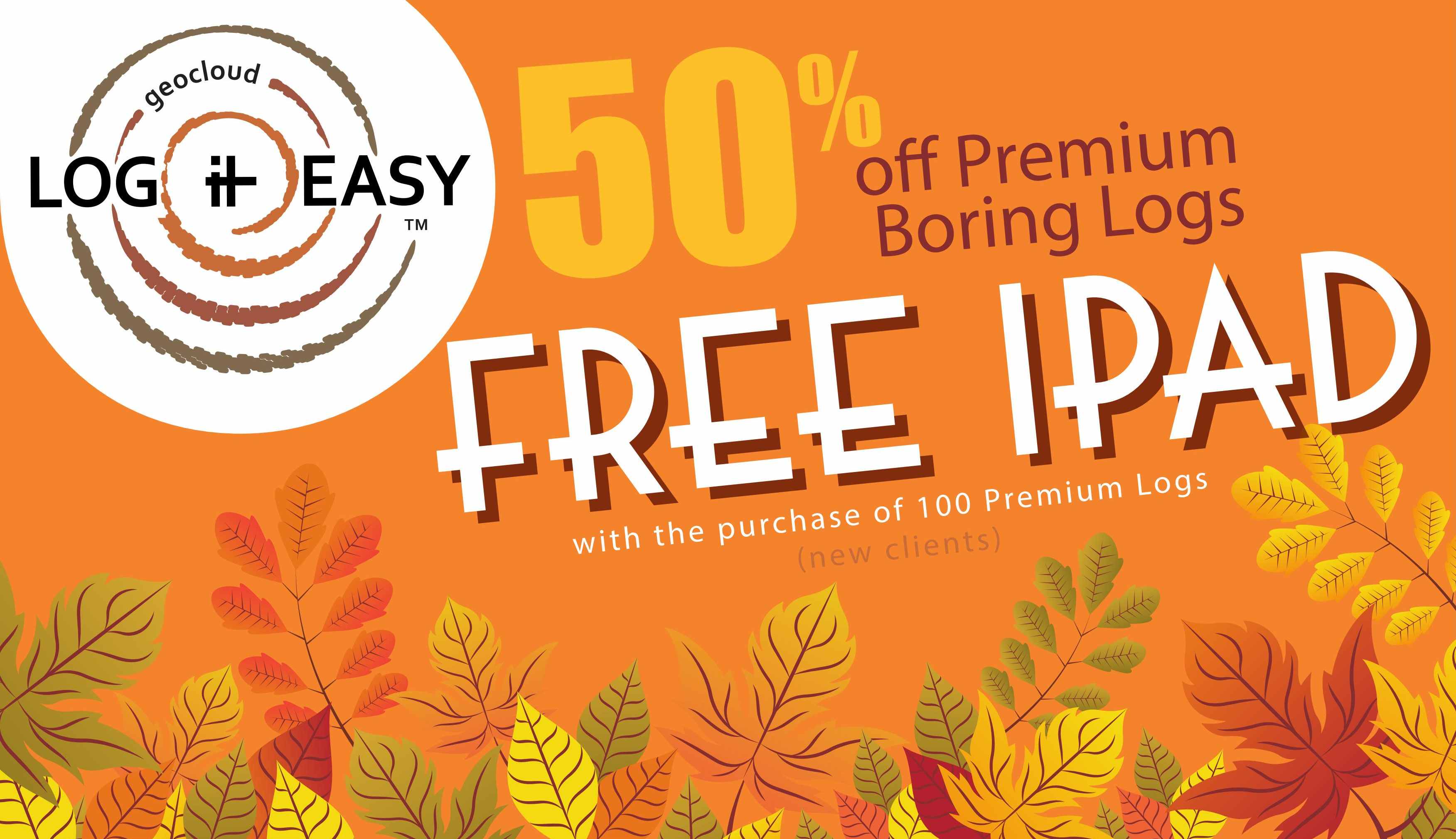
In our biggest sale of the year we offer a free iPad when you start online soil logging! (includes boring logs and cross sections) SIX DAYS ONLY: November 25th through November 30th, 2020 (USA and Canada only) Purchase 100 pre-paid LOGitEASY premium-standard boring logs (including free cross sections) at 50% discount - $10/log, and receive the new 10.2" - retina display iPad, Wi-Fi, 32 GB - https://www.apple.com/ipad-10.2/
Read more2020-11-25

Quick Soil Description Entry
Does your current boring log software provide quick and consistent soil data entry? Save time and improve quality by logging it easy!
Read more2020-09-11
