DIY Geologic Cross Sections and Fence Diagrams Online
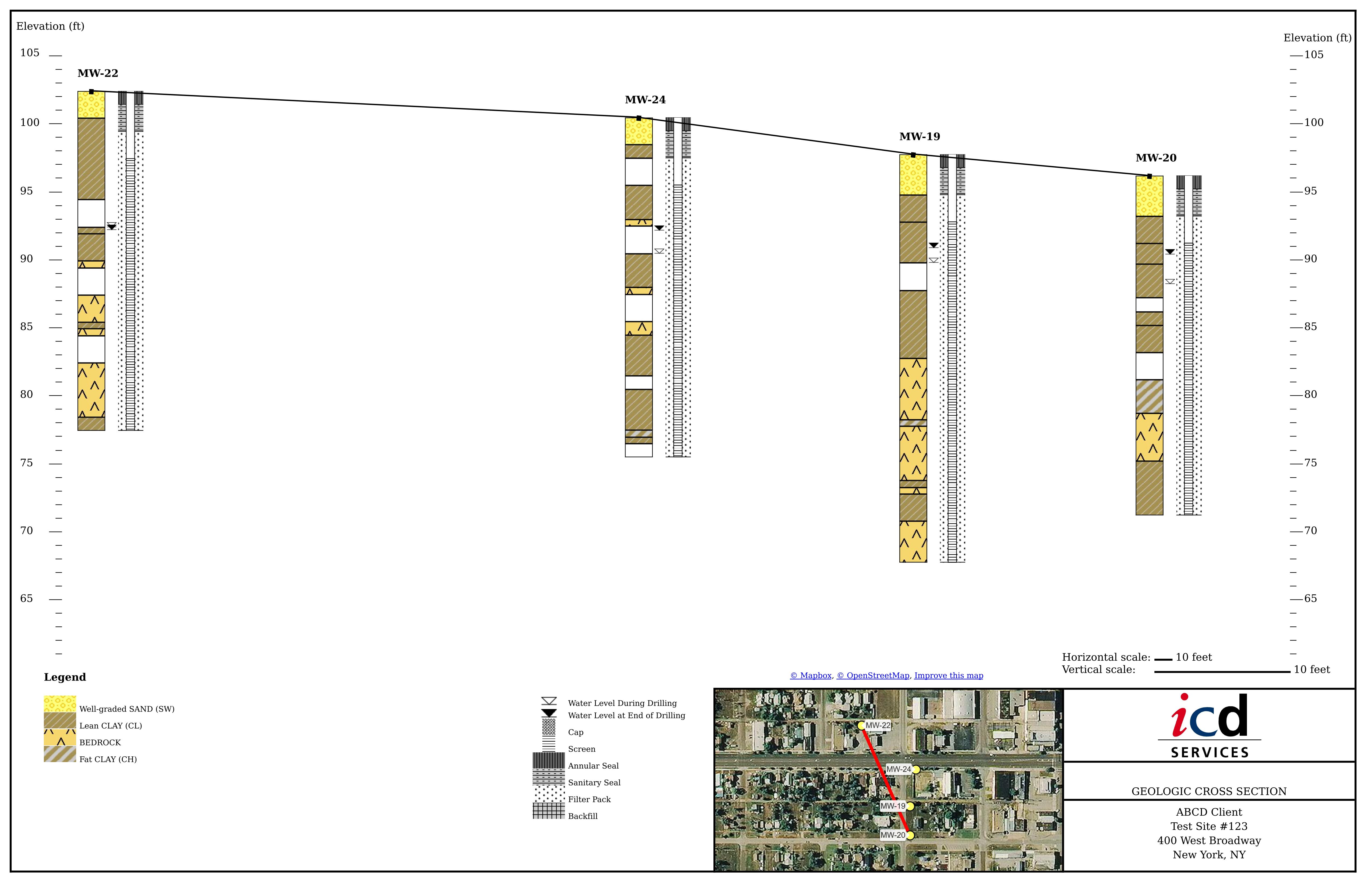
LOGitEASY Report Figure GIS software allows generating instant Geologic Cross Sectionsonline without special GIS or modelling software knowledge.
DIY Geologic Cross Sections can be generated instantly using location data of previously logged LOGitEASY boreholes and monitoring wells. Simply log field data using LOGitEASY eForm, create boring logs online (make sure to add coordinates or select boring locations on a map), then select borings/wells from a list or map, and generate Geologic Cross Section online.
You can also import and visualize various depth related data, such as blow counts, Recovery %, RQD %, soil or groundwater contamination data, etc. If it has depth and a measurement, you can chart it alongside soil descriptions and all other boring log information. Data are imported under the SITES tab, in csv data format.
LOGitEASY instant Geologic Cross Sections include lithology, boring/well construction graphics, groundwater elevations during and after drilling, ground surface elevations and distances between borings/wells. If you require interpolation between borings, we offer our drafting services. We can also create 3D geology models from boreholes created using LOGitEASY eForm or boring logs provided in PDF or other formats.
Cross Section Figures are delivered in PDF format, on 11x17” titleblock, including your logo, client name, site # or name, site address, and aerial inset with the project site and cross section line.
Reach out if you require georeferenced borehole locations, monitoring wells or property parcel boundaries. We can provide geolocated files in AutoCAD dxf, geoJSON, ESRI shapefile, etc. formats in multiple coordinate systems for use with CADD, GIS or 3D modelling tools.
Step-by-step video